
RTK survey
Points with codes and layers, averaging, and photos, sketches and voice notes on every point. The RTK state and precision are always in view.
RTK GNSS · STEREO 70 · eTERRA
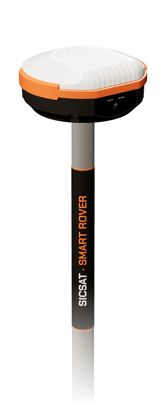
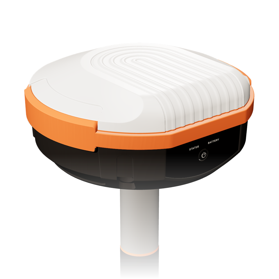
SicSat Smart Rover pairs the ArduSimple RTK Smart Antenna with the SicSat Field app: RTK survey and stake-out in Stereo 70 through the official ROMGEO transformation, drawing on the map, eTerra, PAD and PDF site plans — all on Android.
Features
SicSat Field is built by surveyors for cadastre and construction work in Romania, and tuned for ArduSimple receivers.
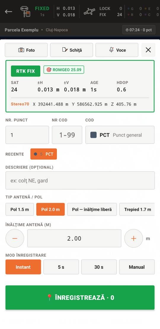
Points with codes and layers, averaging, and photos, sketches and voice notes on every point. The RTK state and precision are always in view.
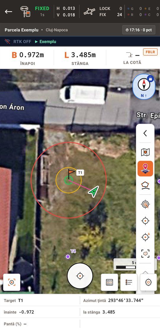
Points, lines and arcs, guided forward/back and left/right or in augmented reality. The stake-out report, sketch included, comes out as a PDF.
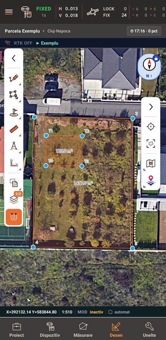
Points, lines, polygons and arcs that snap to corners and sides, geometric constructions, and splitting and merging parcels.
The location and delimitation plan after Annex 16 (ANCPI Order 600/2023), made from the drawing: numbering, sides, neighbours, tables A and B.
A4–A0 sheets at standard scales, with frame, coordinate grid, legend and title block. The preview is exactly the printed sheet.
eTerra's parcels, buildings and built-up area limits on the map, with a cadastral-number search and your own ANCPI account.
The receiver's raw data is logged with the screen off too; at the end you get a RINEX 3.04 file, ready for ROMPOS.
Downloaded base maps for places without signal, and layers from your own WMS servers with adjustable transparency.
DXF, SHP, KML, GeoJSON and TXT/CSV coordinate lists: data straight to and from AutoCAD or QGIS.
The app
Big buttons, good contrast in the sun, and the RTK data always in sight.
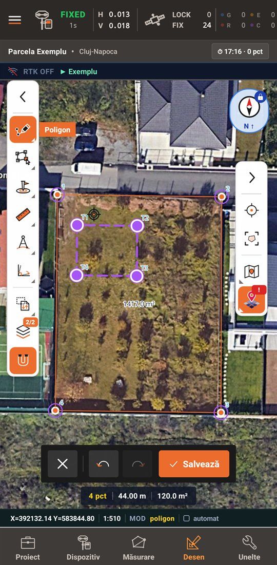
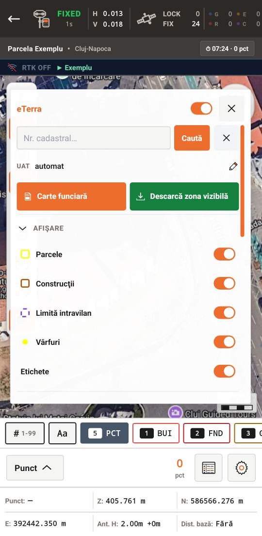
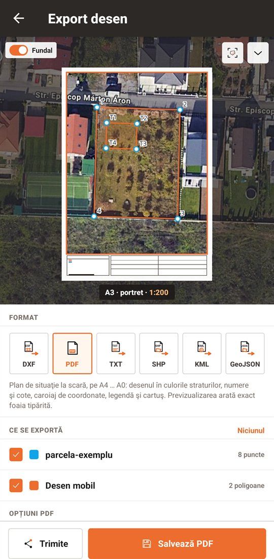
Documents
SicSat Field makes the documents you hand in — from the drawing and the measured points, with no redrawing at the office.
The documents are in the licence's Documents module. During the trial the PDFs carry a DEMO mark.
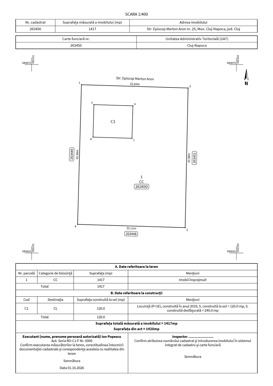
How it works
It connects to the phone over Bluetooth. The Smart Antenna's offsets are already in the app.
The built-in NTRIP client (ROMPOS, for example) brings the RTK corrections; the FIX or FLOAT state and the precision are always in the top bar.
Measure, stake out and draw, then export the stake-out report, the site plan, the PAD or DXF files right from the field.
The kit
Antenna, app and setup from one supplier — with support from surveyors who do the same jobs you do.
Kit price
On request
The price depends on the receiver variant, the accessories and the licence period.
Ask for a quote Already have an ArduSimple receiver? Ask for the SicSat Field licence onlyTry it free
Install SicSat Field on your Android phone and work with your own receiver for two weeks — no card, no commitment.
During the trial the PDF documents carry a DEMO mark. After 14 days without a licence the app stays available for viewing and export. Updates arrive right in the app.
Compatibility
Questions
For RTK corrections over NTRIP, yes: mobile data on the phone. Downloaded maps, projects and measurements stay available without signal.
Phones and tablets with Android 7.0 or newer and Bluetooth.
Stereo 70, through the official ROMGEO transformation, with heights in the Black Sea 1975 system.
Yes, if it is on the list or sends NMEA over Bluetooth. Tell us the model and we will confirm.
Without a licence the app stays usable for viewing and export. Survey, stake-out and drawing go on once you activate a licence, right in the app.
Yes. A licence is active on one device; release it in the app and activate it on the new phone.
A licence module that gives you the PAD, the stake-out report and the site plan without the DEMO mark.
The price depends on the receiver variant, the accessories and the licence period. Tell us what work you do and we will send a matching quote.
Contact
Tell us what work you do and we will recommend the right receiver and accessories.
SicSat Innotech S.R.L. rtk@sicsat.xyz · +40 745 055 099